SityTrail Switzerland - Hiking GPS - Maps offline 10.6.2
Free Version
Publisher Description
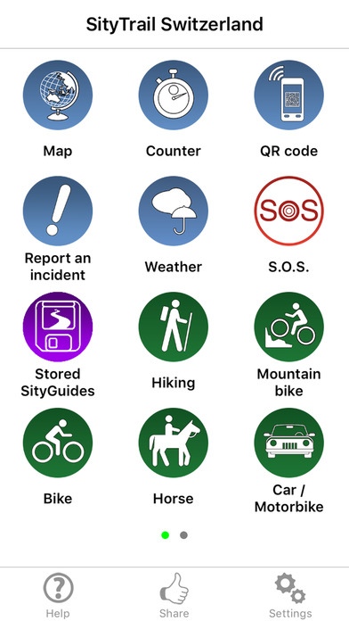
SityTrail is a GPS for all of your outdoor activities anywhere in Switzerland. Here are its main functions: SWISSTOPO TOPOGRAPHIC MAPS IN YOUR POCKET All the swisstopo topographic maps you need to discover Switzerland on foot, cycling, horse riding, or by car, motorbike or quad. Subscription charge: The application can be accessed for free for a week s trial. You may then take out a subscription for 55 CHF per year (EURO54.99EURO - $54.99) or 20 CHF per month (EURO19.99 - $19.99), all-inclusive. MAPS AND YOUR WALKS AVAILABLE IN OFFLINE MODE The download tool lets you get the most out of your maps and routes on the ground without any internet connection. * There is an alarm when you stray from the route being followed. No more need to continuously check your smartphone, this alarm system will stop you getting lost or having to turn back on yourself. Automatic activation of points of interest and text to speech synthesis. An elevation profile that enables the visualisation of inclines and of any difficulties along the route. RECORD YOUR ROUTES WITH PHOTOS Record your walks in real time on the ground, and create points of interest with your own photos and commentary. Display showing distance covered, time taken, average speed, GPS altitude, inclines (+/-), and many other useful indicators for walkers and mountain bikers. Elevation profile for the current recording. CREATE AND SHARE YOUR WALKS With our online editor, create your own walking projects using an internet navigator on your PC/MAC and then accessing them directly from your mobile to experience them on the ground. Go further. Transform your favourite walks into real multimedia guides with text, photos, video links, and share them with the SityTrail community. Access too to thousands of walking circuits from other members and let yourself be guided! TOURIST ATTRACTIONS AND WEATHER SERVICE Get plenty of localised tourist information: articles Wikip dia, accommodation, restaurants, and various services such as chemists and banks. Save your favourite places so you can consult them during your trip. Check on the five-day weather forecast for any location on the map to help you organise your stay. ADDITIONAL FUNCTIONS Easily create points of interest, such as the location of your car, your hotel, or a restaurant. In the event of any problems, the SOS function enables you to send your GPS coordinates to your contacts. Geocachers can use the compass to find their way to a geocache. We wish you lots of fun with SityTrail Switzerland. Application Manual: http://www.sitytrail.com/lang-en/manuals_trail.html For any questions or suggestions: http://www.sitytrail.com/lang-en/support_trail.html - - - Some functions need an internet connection. The prolonged use of GPS can reduce battery levels. * Download limit for maps stored simultaneously on your device for offline use: 5000 km for the one-year subscription (for example, the area of the Canton of Valais) or 2000 km for the one-month subscription. Maps may not be downloaded for offline use during the one-week trial period.
Requires iOS 7.0 or later. Compatible with iPhone, iPad, and iPod touch.
About SityTrail Switzerland - Hiking GPS - Maps offline
SityTrail Switzerland - Hiking GPS - Maps offline is a free app for iOS published in the Recreation list of apps, part of Home & Hobby.
The company that develops SityTrail Switzerland - Hiking GPS - Maps offline is Geolives S.A.. The latest version released by its developer is 10.6.2.
To install SityTrail Switzerland - Hiking GPS - Maps offline on your iOS device, just click the green Continue To App button above to start the installation process. The app is listed on our website since 2012-12-13 and was downloaded 2 times. We have already checked if the download link is safe, however for your own protection we recommend that you scan the downloaded app with your antivirus. Your antivirus may detect the SityTrail Switzerland - Hiking GPS - Maps offline as malware if the download link is broken.
How to install SityTrail Switzerland - Hiking GPS - Maps offline on your iOS device:
- Click on the Continue To App button on our website. This will redirect you to the App Store.
- Once the SityTrail Switzerland - Hiking GPS - Maps offline is shown in the iTunes listing of your iOS device, you can start its download and installation. Tap on the GET button to the right of the app to start downloading it.
- If you are not logged-in the iOS appstore app, you'll be prompted for your your Apple ID and/or password.
- After SityTrail Switzerland - Hiking GPS - Maps offline is downloaded, you'll see an INSTALL button to the right. Tap on it to start the actual installation of the iOS app.
- Once installation is finished you can tap on the OPEN button to start it. Its icon will also be added to your device home screen.
